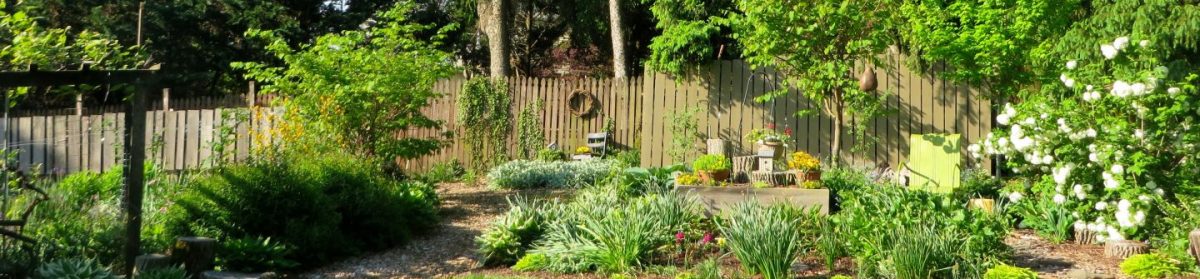
Going straight
How do you respond when someone giving driving directions says, “go straight down this road? During the years I have lived in Pennsylvania and Virginia, I have learned not to laugh at these words coming from a native of either state. I guess there are a few roads that have more than several hundred yards of straightaway. In rural Northern Illinois where I grew up, most of the roads were straight north and south, east and west. Some were graveled roads. In dry weather these wide, straight, gravel roads sometimes saw drivers do speeds of 50 to 60 miles per hour. There were a few exceptions to this straight road rule. A friend of my father lived along a stream. The builder of the house built it to square to the road that angled along the not-so-straight stream. My father’s friend decided that he wanted his house to have the sides of the house to face the directions of the compass. So, the house was jacked up and a new foundation was made under it and the house was now “square with the world”. I wondered afterward if the owner needed the adjustment, too.
County Line Jogs
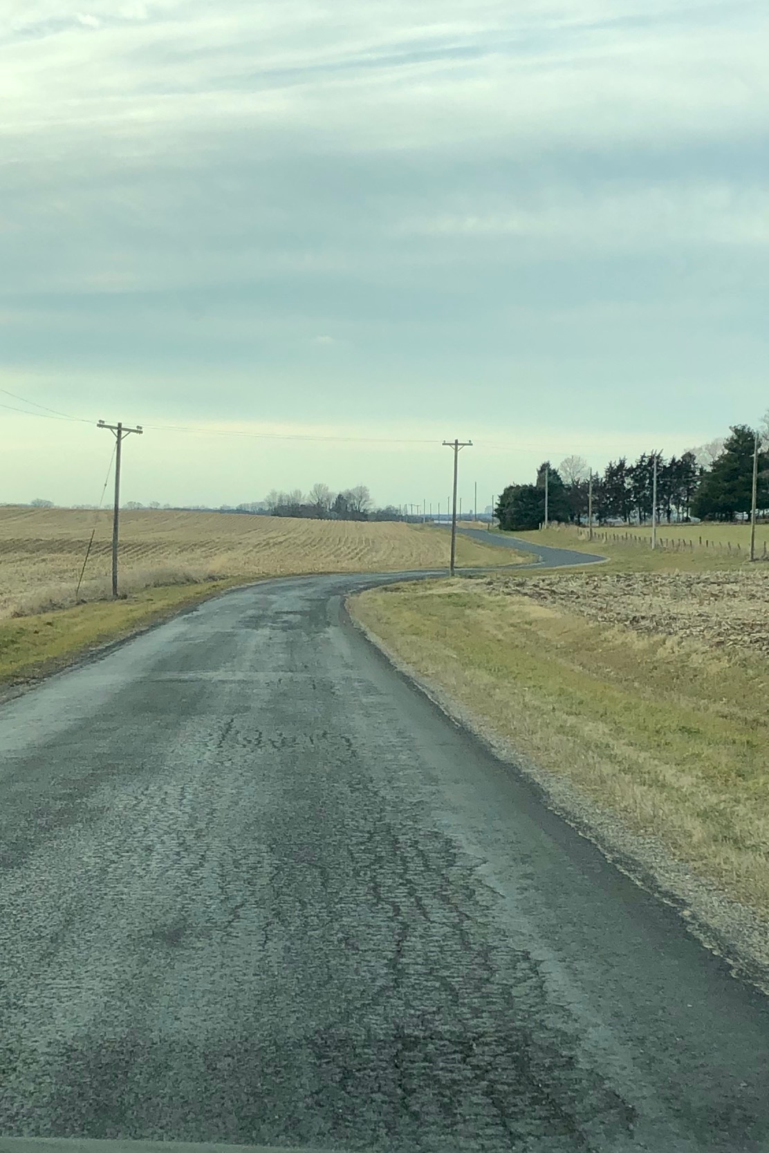
However, an exception to this beautiful arrangement existed due to conflict between instructions to surveyors and the way county road builders worked. The explanation is below.* A slight adjustment at county lines needed to be made. These came to be called county line jogs (CLJ). The jogs might not have been a concern in the horse and buggy days when the roads were built. When I learned to drive in the 1950s, the CLJs on gravel roads were right angle turns with one-hundred-yards to three-hundred-yards between them. As cars got faster, jogs got more dangerous. Forgetting about the CLJ, especially at night, in the fog or when inebriated led to many panic stops, run-over corn plants and serious accidents. (The photo, sent to me by my brother, Joel, shows a modern CLJ with a smoothed-out curve suitable for modern travel.) When I was a teen driver, this road, just west of our farm, was gravel and the CLJ much sharper. This is Covell Road about fourteen miles north of Morrison, Illinois.)
One evening I took my siblings to a youth group event. I had just arrived home from college, perhaps that day and was quite tired. Somehow my sibs must have gotten to youth group meetings in my absence, but I felt it necessary to be the driver. After the fun was over, we headed home. And, yes, I forgot about the county line jog. Fortunately, at the corner was an entrance to a field with little variation in elevation. No damage done to the car. One college guy, though, had damage to his ego.
My sense of direction has always been fairly good. (My view, of course.) Once I heard that Daniel Boone claimed that he had never been lost in his life. But once, he said, “I was pretty confused for a week.” Never for a week, but confusion over directions/where I was has happened. Confusion a bit different happened when we moved from Michigan to Virginia. I slept during part of the trip and when I woke up in Virginia after dark I was not aware/thinking of directions or my orientation. Now, even after living thirty years in Virginia, I need sometimes need to reorient myself that the world is a quarter turn off. West seems to be north! Sometime after arriving in Virginia I read a Natural History Magazine article about someone who had the same disorienting experience. He had someone drive him to Michigan after dark. Then he drove himself back to Washington, DC and that reoriented him so that his innate sense of direction was reestablished. Maybe I should do that.
What’s up and down
The first time I taught history to eighth graders map study was included. One of the indisputable facts I mentioned was that up was north and down was south. The snotty eighth graders started snickering. This community, Kishacoquillas Valley, was less than a mile wide at its widest and probably fifteen miles long. The students assured me that north was “down” and south was “up” the Valley. Some forty years later (after twenty years in the Midwest where roads were straight and north was north and south was south), we moved to Virginia. We found out that due to the course of the Potomac and its tributaries “down” was north and “up” was south. In the Shenandoah Valley one must drive forty-five miles “up” the valley until one can drive “down[south]” toward the James River. In the Kish Valley where I first taught, the students would need to drive a little over eight miles “up” the Valley toward the Tight End of the valley. Just past the welding shop on the west side of the road is a small hill with a sign marking the beginning of Huntingdon County. There the water drains south into Sadler Creek, then to Mill Creek and into the Juniata River. But, my job in the classroom was to help the students get a bigger perspective beyond the Valley. “Up north” and “down south” may not be the whole truth. But it was a language the students needed to understand, at least, if they wanted to understand directions in other places. That was not too different from my father’s friend. Getting square with the world for him would require a broader perspective.
*The Continental Congress passed the Ordinance of 1785 which initiated the requirement that lands be first divided into grids so that lands could be divided and described uniformly, now known as the United Stated Public Land System. There were several ordinances passed following the original of 1785, but in general those ordinances instructed the early surveyors on how to divide the country into those grids. Generally, the surveyors began at a base point and ran meridian lines north and south and a base line which ran east and west. The next phase involved dividing the land into six-mile squares known as townships (these are not governmental townships found within counties). The lines run north and south from the base line were called range lines and the lines east and west from the meridian were known as township lines. The procedure involved placing a wood post on the township and range lines at one-half mile intervals (standard corners). The surveyors later divided the six-mile squares into 36 one-mile squares (sections). The method generally used to create the one-mile squares was to start near the southeast corner of the township and run lines (section lines) north and west once again setting posts at one-half mile intervals. When they would intersect the north and west lines of the previously established six-mile divisions a new post was set (closing corner) which probably would not have matched the older post (standard corner). They did not correct the section line to match the standard corner previously set. This distance between the closing corner and standard corner, or falling, was merely noted and could be within a foot or hundreds of feet different.
When counties began constructing roads, the preference was to follow the range, township and section lines. When a road ran north, let’s say, along a section line and came to the township line, it was necessary to jog the road to be able to run along the section line in the next township north, because of the falling between closing corner and standard corner. Don’t blame the surveyors, they were simply following the instructions given them on how to divide up the land.
http://schneidercorp.com/resources/blog/august-2014/the-jog-in-the-road/#.XGANos9KjOQ

I enjoyed your blog post very much! Knowing some of the areas you mentioned made it even more interesting. I had to chuckle at the man who squared his house might need jacked up also!! (or was it squared?)
LikeLike
Thanks for your comment, Dwight. Wish i would have thought to use the phrase “jacked up”.
LikeLiked by 1 person
ha ha… works either way! Great post!
LikeLike